If you ever need to get Latitude and Longitude of a location, then you can also get Latitude and Longitude from Google Maps also, if you do not have any other ways to get Latitude and Longitude. So, here is a quick Google Maps Tips on how to Get Latitude and Longitude from Google Maps.
Latitude and longitude form the backbone of our modern mapping systems, making activities like navigation, GIS (Geographic Information Systems), and various location-based services possible. Let’s see the devices generally used for obtaining Latitude and Longitude, and later how to get Latitude and Longitude from Google Maps.
Table of Contents
Devices for Latitude and Longitude
If you’re looking to get latitude and longitude, you can use a variety of devices, each suited to different needs and levels of accuracy, such as:
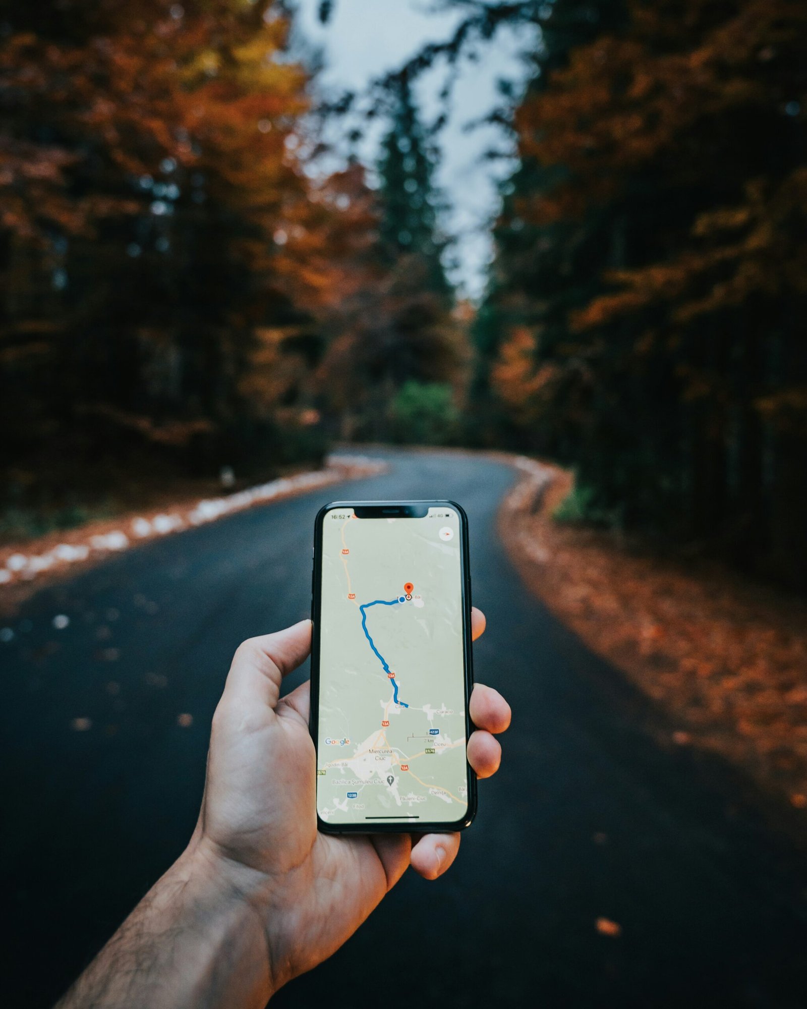
1. Smartphones: Most smartphones come with built-in GPS receivers that can provide accurate latitude and longitude. Apps like Google Maps, Apple Maps, and other location-based apps can display your coordinates. Also you can use dedicated GPS apps on smartphones for enhanced features for capturing and displaying GPS coordinates, such as GPS Essentials or My GPS Coordinates.
2. Handheld GPS Devices: Outdoor GPS Devices like those from Garmin’s GPSMAP series or the Magellan eXplorist series are designed for hiking, geocaching, and other outdoor activities. Also Marine GPS Devices are used for navigation on water, units from brands like Garmin or Lowrance are used to get accurate location data. Devices like the Garmin GPSMAP 86i are designed for marine use and can provide precise location data.
3. Surveying Equipment: High-Precision GPS Receivers such as those from Trimble, Leica, or Topcon are used in professional surveying. They provide high accuracy, often down to centimeters or millimeters.
4. Aerial Drones: Drones equipped with GPS technology, such as those from DJI, can capture and record precise latitude and longitude data during flight, useful for mapping and surveying.
5. Car Navigation Systems: Many modern cars come with built-in GPS systems that provide latitude and longitude as part of their navigation features.
7. Geodetic Instruments: High-Accuracy Geodetic Receivers are used for scientific research and high-precision applications. These systems are often part of networks like the Global Navigation Satellite System (GNSS) and are capable of providing very precise measurements.
Each device’s accuracy can vary based on the technology used, environmental conditions, and the quality of the receiver.
For most general purposes, smartphones and handheld GPS devices are more than sufficient, while professional applications may require more specialized equipment.
Understanding Latitude and Longitude
- Latitude lines, also known as parallels, run horizontally around the Earth. They measure the distance north or south from the equator, which is designated as 0 degrees latitude. The poles (North Pole at 90 degrees north and South Pole at 90 degrees south) mark the extremities of latitude measurement.
- Longitude lines, or meridians, run vertically from the North Pole to the South Pole. Longitude measures the distance east or west from the Prime Meridian, which is set at 0 degrees and runs through Greenwich, England.
- Unlike latitude, longitude lines converge at the poles, making the distance between them variable.
How to Get Latitude and Longitude from Google Maps
Finding the latitude and longitude of a location using Google Maps is a straightforward process that can be accomplished on both desktops and mobile devices.
To begin, open Google Maps and enter the name or address of the desired location in the search bar. Once Google Maps displays the location, you can proceed to get its coordinates.
Steps to Get Latitude and Longitude from Google Maps on desktop / laptop
If you are using a desktop, follow the steps below to get Latitude and Longitude from Google Maps.
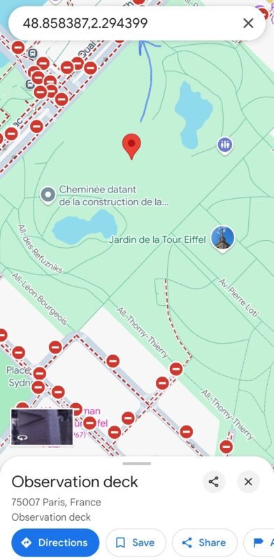
- Open Google Maps in a web browser, right-click on the location on the map, and you will be able to see the Latitude and Longitude displayed.
- Click on the Latitude and Longitude coordinates, and the coordinates will be copied to clipboard.
- Or right-click, select “What’s here?“, and Google Maps will display a small box at the bottom of the screen with the coordinates of the selected location.

Pinpointing a specific location can also be done by dropping a pin. Simply left-click anywhere on the map to place a pin. A box will appear at the bottom of the screen displaying the latitude and longitude of the pin’s location. Click on the coordinates to copy them to your clipboard for further use.
Steps to Get Latitude and Longitude from Google Maps on mobile devices
On mobile devices, the process is equally simple.
- Open the Google Maps app and search for the location.
- Once the location is displayed, press and hold on the screen where you want to pinpoint the place.
- A red pin will drop, and the coordinates will appear in the search bar at the top of the screen.
- Tap on the name or address window that appears to see detailed information, including the latitude and longitude.
By following these steps, you can effortlessly find and utilize the latitude and longitude coordinates of any location on Google Maps, regardless of your device or technical ability.
Applications and Uses of Latitude and Longitude Coordinates
Latitude and longitude coordinates are essential components in a multitude of applications, spanning various industries and everyday scenarios.
- One of the most prominent utilizations of this data is within businesses that rely on logistics and planning. Companies in shipping and transportation use precise geographical coordinates to optimize delivery routes, ensuring efficiency and timely deliveries.
- For software developers, latitude and longitude information enables the creation of location-based services that significantly enhance user experiences. Applications for ride-sharing, such as Uber or Lyft, utilize this data to provide real-time location updates and efficient route mapping.
- Similarly, developers integrate geographic coordinates into websites and applications to offer personalized services such as local weather updates, nearby restaurant suggestions, and emergency services locations.
Everyday users also find latitude and longitude data invaluable in numerous scenarios. Travel enthusiasts can plan their trips more effectively by pinpointing exact destinations and exploring places of interest. For hikers and adventurers engaging in geocaching—a modern-day treasure hunting activity—latitude and longitude coordinates are fundamental in locating hidden caches scattered around the globe.
How to avoid getting incorrect Latitude and Longitude from Google Maps
Obtaining latitude and longitude from Google Maps is usually straightforward, yet users occasionally encounter challenges.
- Make sure the pin placement is accurate on Google Maps for greater precision. It can also be helpful to drag the pin slightly within the vicinity to refine the accuracy of the latitude and longitude readings. Double-check the displayed coordinates to ensure they match the intended location.
- Difficulty could also stem from permissions or settings.
Ensure that Google Maps has access to your device’s location services. On mobile devices, this generally involves checking your app permissions under device settings. For browsers, ensure that location services are enabled and that the specific site has permission to access your location data. - Improving the accuracy and efficiency of obtaining coordinates can also involve the use of specific tips and tricks. For instance, utilizing satellite view often enables more precise pin placement by providing a clearer image of the geography and landmarks.
- Additionally, consider double-checking coordinates against a reputable secondary source for verification.
As mentioned above, there are specialized devices for obtaining Latitude and Longitude for special purpose or specific requirements. However, for most users, we can easily obtain Latitude and Longitude from Google Maps for general purposes, either from desktop or from mobile devices.
Let us know in the comments below why you need to obtain Latitude and Longitude, and whether you use Google maps or any other devices for obtaining Latitude and Longitude.
Leave a Comment (FB)